DEMOGRAPHY
Geophysical Location
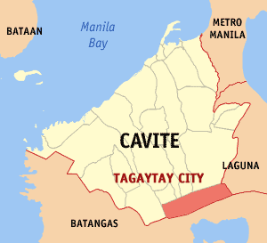
Tagaytay City is located in the Province of Cavite, island of Luzon. It is approximately 56 kilometers south of Manila, with a total land area of 6,500 hectares, which represents about 5.14% of the total land area of Cavite. It lies within 120o 56� latitude and 14o 16� longitude and overlooks Manila Bay on the north, Taal Volcano and Taal Lake on the south and Laguna de Bay on the east.
The city is linked by the national highway to the Metropolitan Manila Area and to the Province of Batangas. It is also connected by roads to the adjoining municipalities of Amadeo, Mendez, Indang, Silang and Alfonso in Cavite towards the northwest, to the municipalities of Calamba and Sta. Rosa in Laguna in the northeast and to the town of Talisay in Batangas in the south.
Population Size and Growth Rate
As per 2015 PSA report, the city's total population is 71,181 and the city's household population is 16,095. Since Tagaytay is a major tourist destination, population doubles on weekends and holidays due to influx of tourists and visitors.
The recent population reports shows the annual growth rate of 2.79% from the 2010 NSO census with total of 62,030.
| Asisan | ||
| Bagong Tubig | ||
| Calabuso | ||
| Dapdap East | ||
| Dapdap West | ||
| Francisco | ||
| Guinhawa North | ||
| Guinhawa South | ||
| Iruhin Central | ||
| Iruhin East | ||
| Iruhin West | ||
| Kaybagal Central | ||
| Kaybagal North | ||
| Kaybagal South | ||
| Mag-asawang Ilat | ||
| Maharlika East | ||
| Maharlika West | ||
| Maitim II Central | ||
| Maitim II East | ||
| Maitim II West | ||
| Mendez Crossing East | ||
| Mendez Crossing West | ||
| Neogan | ||
| Patutong Malaki North | ||
| Patutong Malaki South | ||
| Sambong | ||
| San Jose | ||
| Silang Crossing East | ||
| Silang Crossing West | ||
| Sungay East | ||
| Sungay West | ||
| Tolentino East | ||
| Tolentino West | ||
| Zambal | ||
| TOTAL |
Source: Tagaytay Ecological Profile 2016

TAGAYTAY CITY HALL
(046)-888-9500
PNP
(046)-413-1282
0915-913-7693
0998-598-5603 to 04
OSPITAL NG TAGAYTAY(ONT)
(046)-423-3195
(046)-483-2160
Tagaytay City Rescue(CDRRMO)/TOPS
(046)-483-0446
BUREAU OF FIRE PROTECTION (BFP)
(046)-483-1193
(046)-471-3747
0942-989-8495
CITY HEALTH OFFICE (CHO)
(046)-483-0604
CSWDO
(046)-483-0494